Showing posts with label Egypt Bay. Show all posts

17 April 2014

The Great Escape - a walk from High Halstow to Allhallows

With improved weather and a need to lose a few pounds (or more), I escaped the hustle and bustle of village life last weekend, to explore some of the great wilderness right here on the Hoo Peninsula.

With my Gravesend, Rochester and Hoo Peninsula map (Ordnance Survey 163) and some tasty spam sandwiches in hand, I set out on Saturday morning along footpath RS42, at the end of Longfield Avenue in High Halstow.


After zig-zagging through fields and a bluebell filled woodland I eventually joined up with Decoy Hill Road, where I headed north for Egypt Bay – on the signposted ‘Curlews, Convicts and Contraband’ walk.


Egypt Bay is at the end of Manor Way, along Halstow Marshes, and this quiet spot marked the completion of my first couple of miles – making it the perfect place to grab a bite to eat (a spam sandwich no less). Aside from imagining Abel Magwitch wading ashore from a dirty old prison hulk, made famous in the opening sequence of Great Expectations, Egypt Bay is a great place to observe shipping activity on the Thames and to glimpse over to the container port at London Gateway and neighbouring Canvey Island. The only interruption was a herd of curious cows (there must have been more than 50).


After the excitement of the cows, it was time to head east along the northern coastline, in the direction St. Mary’s Bay, St. Mary’s Marshes and Dagnam Saltings.


Although only a handful of miles from some of our local villages, the route along the Hoo Peninsula’s northern edge can feel extremely remote and distant. I met only four other walkers, a cyclist and a couple fishing the entire time I was out.


Four hours after setting off from High Halstow and having covered a distance of eight miles – I finally arrived in Allhallows, to the rear of The British Pilot pub. I didn’t have time though for a swift ale on this occasion.

It was great getting out to enjoy the fresh air and nice weather, and to spend some time appreciating our unique local landscape.

I hope to go for more long walks this summer, but maybe with fewer spam sandwiches next time!
  

4 September 2011

Egypt Bay - feedback from Mervyn King

Following my recent posts asking if anyone knew how Egypt Bay came to get its name, I have received another interesting suggestion, this time from Mervyn King. 


Mervyn told me about a reference to Egypt Bay in a book called ‘The Thames’ by A. P. Herbert, which was published in 1966 by Weidenfield & Nicholson (pictured below).


A. P. Herbert (Sir Alan Patrick Herbert) says: ‘Egypt Bay, a strange sandy indent, so named, I suppose, because of the sand’.

I recently looked online for some old maps of the area, and there’s a really good website called Old Maps. A very useful commercial site that contains many old maps of the area, dating back to 1872, all of which can be easily viewed online.

The 1872 map itself shows Egypt Bay to have been joined by a sizable stretch of marshland known as Egypt Saltings – with ‘The Kite, Coast Guard Station’ located near its mouth with the Thames. The indent of the bay was much bigger in those days, with most of what was Egypt Saltings having long since silted over.

Any more ideas? Use the contact page to let me know if you have any views on how Egypt Bay got its name.
 

14 August 2011

Egypt Bay – feedback from Malcolm Coomber of High Halstow

Following my recent post about how Egypt Bay got its name, I’m really pleased to report an interesting development!


My thanks go to Malcolm Coomber, from High Halstow, who got in touch with a possible explanation . . .

Dear Tony,

In response to your enquiry about how Egypt Bay got its name, I may have come up with a long shot that might be worth exploring.

I have a book called ‘The Hoo Peninsula’, written by local historian Philip MacDougall in 1980, which mentions Phoenician artefacts being found in Hoo and Higham.


This book states the following:

"During pre-historic times Hoo St. Werburgh was probably a fairly important settlement. The discovery of a Phoenician coin at a point just south of the present village also suggests that Hoo may also have been a small trading centre. The coin was discovered in 1903 and is said to be a drachma dating from the reign of Philip of Macedon. This particular king will probably be better recalled if one remembers that he was the father of Alexander the Great.

The importance of the coin demonstrates that Kent had trading links with the Phoenicians, traders who ranged far and wide bringing with them such saleable commodities as silver, high quality pottery and wines. Perhaps, indeed, it was the Phoenicians who brought the imported pots found near Cliffe. It should be pointed out that these pottery fragments do not come from so far east but would have been collected by the Phoenicians on their journeyings.

Hoo is not the only place in North Kent where Phoenician coins have been found. Not very long ago a number of such coins were unearthed at Higham. They were all contained inside a hollow flint purse."

The Phoenicians came from a land called RETENU (CANAAN) which had a direct boundary with EGYPT.

Just a thought! Did they sail up the Thames to trade and come across what we know as Egypt Bay, and named it such due to the unlikely event of finding a sandy beach in an unlikely spot on the River Thames? Stranger things have happened!


Best wishes - Malcolm.

Many thanks Malcolm for getting in touch and sharing your thoughts. A possibility certainly worth looking into!

Personally, I hope he’s right. Having been to Egypt and spent time exploring the Nile near Luxor, it would certainly be nice to think the two distant, but equally tranquil, locations were somehow connected.


I'm also grateful to everyone who got in touch to share stories about enjoyable walks around this bit of the peninsula.

Use the contact page to let me know if you have any views on how Egypt Bay got its name.
 

29 July 2011

Egypt Bay

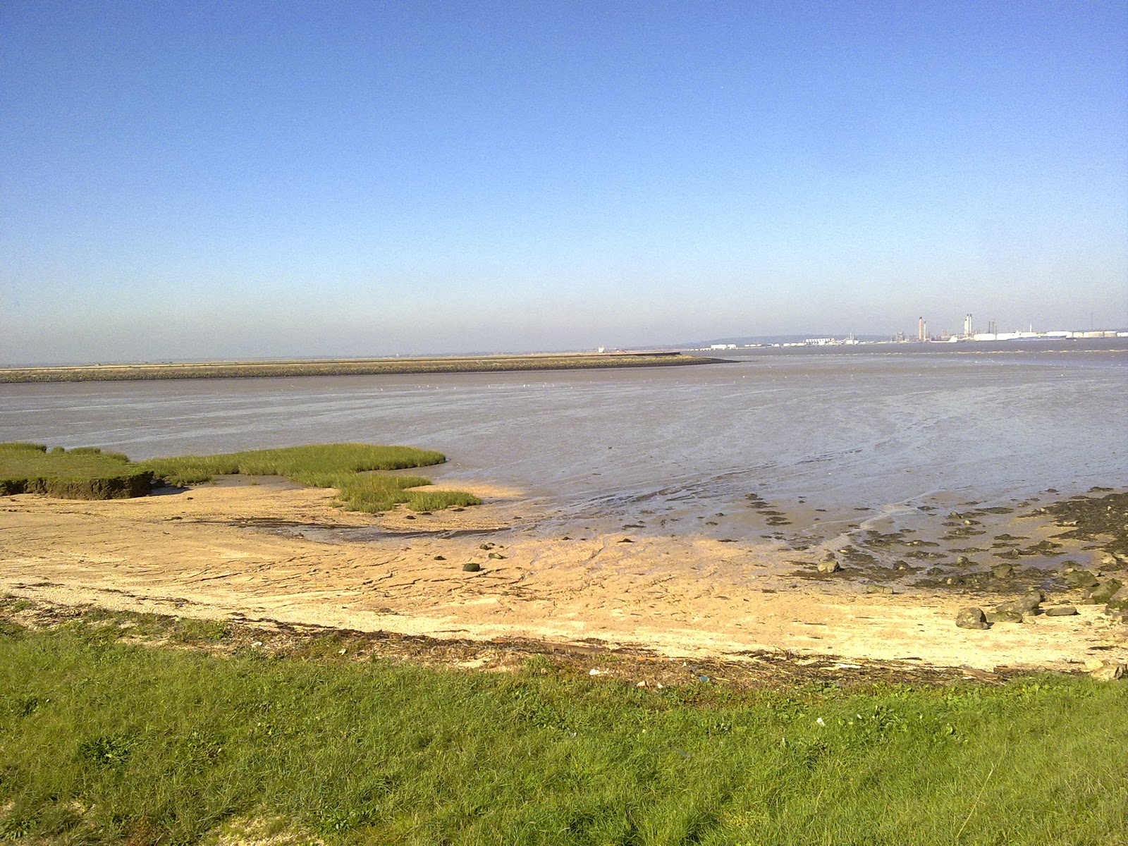
Someone recently asked if I knew how Egypt Bay (pictured below) came to be named. I had to admit I had no idea! A favoured landing spot for smugglers, Egypt Bay was also home to Napoleonic prison hulks.


I would really like to hear from anyone who might be able to shed light on this one. Just get in touch via the contact page.
 

3 January 2011

Christmas Day Walk - Allhallows

With festivities over and life returning to normal, Christmas Day seems like a long time ago. The weather has improved a bit, for the time being, and no doubt everyone has been busy making resolutions.

I made an early pledge – to do more regular exercise! On Christmas Day I went for a long walk from Allhallows and was joined by friends and a dog called Jake.

We set out from Allhallows at 10.30am and went through the Leisure Park and along the beach, past the Yacht Club, aiming for West Point and St. Mary’s Bay. We hoped to get as far as Egypt Bay, before returning to Allhallows, but it took much longer than expected to walk to St. Mary’s Bay (due to long sessions of playing ball with the dog). At 12.30pm, with lunch still to cook, we took the decision to abandon the attempt to get as far as Egypt Bay. We headed back to Allhallows, cutting across footpaths that led through marshes and fields, eventually passing behind Dagnam Farm.

We arrived back at Allhallows at 1.30pm and headed home for the usual Christmas Day excitement and to finally open some presents!


10 October 2010

Curlews, Convicts and Contraband (walking route), St. Mary Hoo

Making the most of the sunny weather, I headed to St. Mary Hoo this morning and joined public footpath RS22, before linking-up with the ‘curlews, convicts and contraband’ walking route. There were great views of the estuary as I walked across St. Mary’s Marshes and Halstow Marshes to St. Mary’s Bay and Egypt Bay. A favoured landing spot for smugglers, Egypt Bay was also home to Napoleonic prison ships.

From St. Mary Hoo (The Street), I walked towards Ross Farm and followed the road past The Old Rectory, where walking markers are placed. I followed these markers down through a number of fields before reaching St. Mary’s Bay.


The route between St. Mary’s Bay and Egypt Bay is clear, offering numerous opportunities to enjoy the views.

Although both St. Mary’s Bay and Egypt Bay are similar looking, Egypt Bay has had concrete sea defences added.


10 June 2010

Clinch Street and Decoy Hill Road

Clinch Street leads into Decoy Hill Road, both of which run from Britannia Road (between Fenn Corner on the A228 and High Halstow). Luckily, the weather was pleasant when I had a stroll along these roads, but I still have much to explore, including further exploration of Halstow Marshes to Egypt Bay – famous for its historical smuggling links and where prison hulks once anchored.